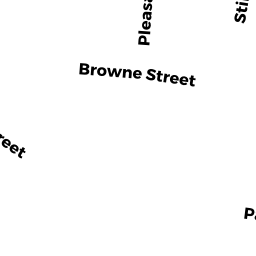
77 BROWNE ST
Owner Information
LAGOS TRS CONSTANTINE B & LILLIAN
77 BROWNE ST #1
BROOKLINE, MA 02446


Property Details
77 BROWNE ST is classified as a Three-Family Residential (Row end).
The primary structure on this property was built in 1913. There is 6,558ft2 of residential/living space within this property. This property is listed as having 18 rooms. There are 3 units within this property.
77 BROWNE ST is valued at $2,667,200. The land is valued at $885,500 and the structures are valued at $1,781,700.
This property is in Zone M15. Confirm with local Zoning Board authorities to ensure there are no overlays or other easements on this property.
The most recent deed for 77 BROWNE ST is recorded at the local registrar in Book 31802, Page 160. 77 BROWNE ST was last sold on Friday, October 4, 2013 for $1.
Assessment data from fiscal year 2021.
Flood Data
According to the FEMA National Flood Hazard Layer, this property does not appear to be in a flood zone. It may also be in an area not yet reviewed. Nonetheless, confirm this information prior to taking any action.
To view the flood hazards around this property, create a FEMA "Firmette" Map of the area around 77 BROWNE ST.
Broadband Internet Providers
| Provider | Type | Bandwidth (mbps) | |
|---|---|---|---|
| HughesNet | Satellite | 25 | 3 |
| RCN | Cable | 500 | 20 |
| Viasat Inc | Satellite | 100 | 3 |
| Crown Castle Fiber | Fiber | 0 | 0 |
| Comcast | Cable | 1000 | 35 |
| RCN | Cable | 1000 | 20 |
| Verizon New England Inc. | DSL | 15 | 1 |
| VSAT Systems, LLC. | Satellite | 2 | 1 |
| Starry, Inc. | Fixed Wireless | 200 | 200 |
| netBlazr Inc | Fixed Wireless | 50 | 50 |
| T-Mobile | Fixed Wireless | 25 | 3 |
| GCI Communication Corp. | Satellite | 0 | 0 |
Broadband service provider data from December 2020.
Adjacent Properties
- 83 BROWNE ST
Three-Family Residential owned by LIU, TRS WILSON-NELSON-JASON - 101 BROWNE ST
Three-Family Residential owned by GORMAN III JAMES R - 112 PLEASANT ST
Three-Family Residential owned by LUNG PAULINE Y - 104 PLEASANT ST 1 & P1
Residential Condominium owned by SCHLAFF ANTHONY & MARY - 104 PLEASANT ST 2
Residential Condominium owned by GHOSHAL ARNAB - 104 PLEASANT ST 3 & G3
Residential Condominium owned by ANSELL AMY E - 106 PLEASANT ST
Three-Family Residential owned by LOO, TRS ROBERT N & TERESA H